Distance 6.2 miles (10km)
Classification Moderate
Duration 3 hours
Begins Butt Lane, Slindon
OS grid reference SU959086
Walk in a nutshell
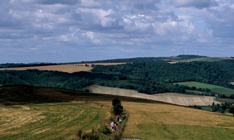
This circular walk captures the grand scale and variety within the 3,500-acre Slindon Estate. Beginning at the Sussex flint village of Slindon, it heads north towards Bignor Hill, through sun-dappled woodland, and down Stane Street past fields of sheep. After threading through stands of mature beeches, the route rises up Nore Hill before dropping back down to the start via a farm track and a quiet lane.
Why it's special
Hilaire Belloc eulogised this part of the South Downs, declaring it to be his favourite place on Earth. There are some great views from Gumber Corner – which doubles as a top picnic spot – but the best is left until close to the end when, from Nore Hill, you can plop yourself down on a bench and drink in a panorama that stretches over fields and trees all the way to the sea. Go in winter and even more vistas are revealed through the leafless trees.
Keep your eyes peeled for
Deer in the woods and pyramidal orchids in the chalky dip just before Nore Hill. Stane Street was built by the Romans to link London and Chichester and the section that runs through the Slindon Estate is a wonderful grassy affair you can walk in bare feet should you choose.
Recover afterwards
At the Old Stables in the nearby village of Fontwell, where you can enjoy a meal, real ale and an open fire.
If it's tipping down
Arundel Castle hosts exquisite works of art, furniture, tapestries, china, sculpture, clocks and good old-fashioned suits of armour.
How to get there
Take the train to Chichester, then catch the 84 bus to Fontwell. Walk up London Road opposite the bus stop, and bear left for the underpass beneath the A27. This will bring you out on to Dukes Road, adjacent to Slindon South Lodge.
Step by step
1 From the five-bar gate at the beginning of Butt Lane, walk steadily up towards Bignor Hill. Ignore the many left-hand tracks/turnings and either keep level or go upslope, and head straight or tend to the right. There will be trees or a hedge to your left, while to your right the view will frequently open out over fields.
2 Around 2 miles into the walk, you re-enter rough woodland for the last few hundred metres up to Gumber Corner.
3 The sweep of the "Gallops" will be to your right. At the top you'll meet an east-west bridleway at Gumber Corner; head left into mixed woodland.
4 Continue for about 50m along the path until you see, to your left, the fence, farm gate and walkers' stile at the top of Stane Street.
5 Continue south along Stane Street for a mile or so, heading for Eartham Wood.
6 When you reach a clearing at the Six-Ways signpost (where eight ways now meet), take the path to your left, with a "no horses" sign to its right and a waymarker post to its left.
7 About 200m after a pole-gate partially crosses the way, turn right at a signpost to your right and walk across the northern flank of Nore Hill.
8 Turn left uphill at the second signpost, to the right of the track beside a "no horses" sign. Follow the way up, through a pole-barrier and across the top of Nore Hill.
9 After you come out into the open, keep the woods to your right for 200m until Nore Hill folly.
10 Take the farm track downhill then, at the T-junction adjacent to Row's Barn, turn away from it, heading to your left.
11 Just past the farmyard to your left, turn right on to Nore Hill Lane. This takes you back to your starting point.

