Distance 9.25 miles (15km)
Classification Moderate
Duration 4 hours
Begins Layby off Berry Shute, Chillerton
OS grid reference SZ481829
Walk in a nutshell
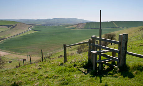
An undulating walk through largely undiscovered territory in the middle of the island. The route sends walkers up hill and down dale, through woods and across fields, via the tiny communities of Gatcombe and Chillerton. And if that sounds like too much, there's a shortcut you can take to reduce the walk to about 4.5 miles (7.2km) – after step 2 turn right, carry along the track for 60m, then continue from step 6.
Why it's special
Stand next to the transmitter mast on top of Chillerton Down, look south and you'll see Chale Bay, whose notorious Atherfield Ledge has drowned many a sailor over the centuries. To your east are the sandy beaches of Sandown while to the north, sits Cowes at the mouth of the river Medina.
Keep your eyes peeled for
The remains of an iron age fort on Chillerton Down. There's a rampart and ditch visible though the fort was never finished. It's known locally as the Five Barrows because depressions in the bank give the impression of five separate mounds. Further on, try to spot the Gatcombe Withy Bed – a small parcel of low-lying land planted with willows coppiced for baskets and lobster pots. The tower rising above it is from the old Whitecroft hospital, an asylum founded in 1894.
Recover afterwards
If you have children with you, head for nearby Rookley where the Chequers Inn sports its own adventure playground. If child-free, try the Taverners at Godshill, which specialises in locally sourced dishes such as venison pie with root vegetable mash, all fresh from the island.
If it's tipping down
Carisbrooke Castle – besieged by the French, coveted by the Spanish, and prison to King Charles I – is about 4.5 miles (7.2km) away. You can even play a genteel game of bowls on the very green the doomed monarch used (though if it's still pouring with rain you may wish to pass on that).
How to get there
Hop on the hourly Southern Vectis bus 6 between Newport and Ventnor, leaping off at Chillerton Farm.
Step by step
Follow OS map OL29.
1 Take the G13 bridleway to the base of Chillerton Down, ignoring a path to the left. After a gate, follow a grassy track to the left. Just before another gate, bear right on to the open-access hillside and climb steeply up the grassy bank to the right of an old pit area. Pass an isolated gorse bush and continue climbing to reach the perimeter fence of the Chillerton Down transmitting station.
2 Turn right and follow the fence. At the boundary corner, cross a stile and head diagonally left to a wooden bench and viewpoint at the fence corner. Follow the ridge to a stile near the top field corner and continue, descending slightly to the far lower corner of the next piece of open land. Cross the stile and turn immediately left for 25m, then go over another stile and follow the path through the copse. Go straight on at the signpost and reach a crossing track.
3 Turn left as far as a minor road, then turn right. At the road junction, turn right for 45m then turn left up bridleway G6. At a path junction at the top of the hill, turn right along bridleway G10. Carry on at a road in the same direction to meet a main road. Turn right for 140m then left along footpath G5 to a minor road. Turn right and head downhill to a major road. Turn right for 220m using the pavement, then take footpath A42 on the right, behind the bus stop in front of Blackwater Mill.
4 Cross two stiles, keeping to the field edge with Gatcombe Withy Bed on the right. Turn right through a metal gate just before farm buildings and, shortly, a second gate. Continue through the wood, then over a bridge to reach a wooden gate in a gap in the hedge on the right. Go through and proceed along the grassy track bending left around private buildings. Turn left at a track then right at the main road. Take the first road on the left after 140m.
5 When the road bends right by St Olave's church, carry straight ahead on footpath G11. Bear right after two houses and right again to follow a gently rising bridleway.
6 Turn sharp left at the last field before a wood and follow its left edge. Continue along bridleway G6. Turn left at the road for 175m, using the footpath on the far side of the road. Turn right by Chillerton village hall and up bridleway G15a. Bear left then right when it emerges into the open, still rising.
7 At the crest of the hill, take footpath G15 just to the right of the hedge on the right. Continue along the ridge top almost to the summit of Berry Hill, then descend diagonally left, just below a line of scrub. At the road, turn right as far as a main road. Turn right for 200m and back to the start.

