Distance 23 miles (37km)
Classification Moderate
Start Dundas Aqueduct, near Limpley Stoke, BA12
Finish Frome railway station, BA11
Duration 2–3 hours
Route NCN route 24
Map Severn & Thames cycle map, AA guide Cycling in the South West of England, OS Landranger 172 or 183, Explorer 155 or 142, Colliers Way leaflet
Route notes
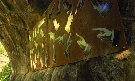
A picturesque meander along disused railway lines and quiet country lanes, through the heart of the county's industrial heritage, which includes the former mining communities of Radstock and Kilmersdon. The route features works created by artists working with local schools based on Somerset's disappearing orchards, industrial heritage and physical geography, including work by Jerry Ortmans, Elizabeth Turrel and Imi Maufe.
Terrain and gradients
Some of the road sections can be quite hilly – particularly in Shoscombe. But most of the route is offroad, traffic-free and easy-going. There are some country lanes and a busy road in Radstock.
How to get there/away
The start is a few miles from Bath. Frome has a railway station.
What to see
Dundas aqueduct was built at the turn of the 19th century to carry the Kennet and Avon canal over the river Avon. Radstock has a museum showcasing its mining past. Frome is a vibrant market town. A plaque on the wall in Kilmersdon records the local belief that the nursery rhyme Jack and Jill is based on a local event that took place in 1697.
Watering holes
Several options in Radstock, Midford, Kilmersdon and Frome. Cyclists are always welcome at the Apple Tree Inn in Shoscombe.

