Distance 10 miles (16.1km)
Classification Challenging
Duration 4 to 5 hours
Begins Marsden Moor estate office
OS grid reference SE047118
Walk in a nutshell
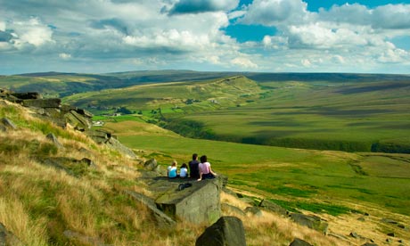
Kicking off from Marsden, alarge village dominated by high moors on three sides, the route lassoes a large swath of Marsden Moor, including March Haigh reservoir, and proffers views of the surrounding moorland.
Why it's special
Marsden Moor may be deserted now but it wasn't ever thus. Human activity has been carried out here from the Neolithic era through to the bronze age, Roman times and the Industrial Revolution, and this walk gives you a taster of every period.
Keep your eyes peeled for
At March Haigh reservoir look across to March Hill, one of Britain's primary Mesolithic sites, where flint tools have been excavated and hearths uncovered from beneath the peat. The Roman road from Chester to York once cut across Standedge (the ridge offers the narrowest point across the Pennines, thanks to the river Colne and river Tame cutting back the millstone grit) and you can still see traces of it as you climb from Castleshaw (site of a Roman fort) to Millstone Edge. At Pule Hill a small bronze-age cemetery was discovered. Also look out for air vents on the flanks of the hill that serve the two railway lines and canal that pass through Standedge tunnels. Up above you may see moorland birds such as curlew and merlin, and, possibly, the rare twite. Beneath your feet you'll find bilberry and crowberry as well as sundew, a plant that kills and devours unwary insects.
Recover afterwards
At the Riverhead Brewery Tap and Dining Room in Marsden.
If it's tipping down
There's Saddleworth Museum in nearby Uppermill, where you'll find the history of the six villages of Saddleworth and a gallery championing local artists.
How to get there
Take the train to Marsden – the station is right next to the start of the walk.
Step by step
1 From the estate office, head towards the train station and then onwards along the canal until you reach the Standedge Tunnel visitor centre.
2 Head up to Waters Road. Walk up the drive beside the Tunnel End pub and then take the path behind it. Walk across fields through a green gate to a group of houses.
3 Go through another gate beside the house on the right to bring you out on a lane. Turn left and follow it past Berry Greave. When it starts to descend downhill, turn right and follow this lane past the first house and round to a path at the back of the next house. Walk across the fields and at the small footbridge keep to high ground before you drop sharply down to a stream and back up again to the right of the phone mast. Turn right down Blake Lee Lane past Lower Green Owlers to a road junction. Turn left and climb up the track to White Hall Farm. In front of the farm go through the gate leading on to the moor and through some rushes, following the path along the edge of Haigh Clough to the southern corner of March Haigh reservoir.
4 Here you have the option to head up to Buckstones car park for magnificent views across the estate. Cross the dam wall and take the path through the rocks to the car park. Once you've caught your breath, retrace your steps back to the dam wall.
5 Continue to head south to meet up with the Packhorse Trail, where you turn right and follow the trail across Willmer Clough and up to the top to one of the old marker stones. Go straight ahead until you reach Haigh Gutter.
6 Turn sharp left to follow the Pennine Way south, making sure that when you come to a square marker stone you follow the path to the left, keeping Millstone Edge on your right. You will shortly arrive at the trig point at Dinner Stones.
7 Continue along Millstone Edge through a kissing gate into a field. Go through the next gate and turn left along a path over a stile and down Thieves Clough. Follow a broken wall until you come to the old engine house.
8 Follow the track over Redbrook Clough and on to the A62. Turn right in front of the Carriage House pub and continue for a short distance before turning left down Mount Road. Continue for 500m, then take a path left along the Standedge Trail. The path here is boggy to begin with but soon dries out to contour around the front of Pule Hill. Be careful not to wander up the hill but stay level, near the telephone wires, going over two stiles. Walk behind two houses before taking the path left on to the A62. Cross the road and walk downhill a short distance to a path called Dark Lane which leads you steeply down between two walls to Eastergate. Cross the river at the bottom; it can be quite high after rain soyou may end up with wet socks even when crossing at the shallowest point on the right.
9 Cross over the Packhorse bridge, following the path to the road and then down to Hey Green hotel. Continue along Waters Road until you pass the former coach house and turn right on to a path that runs alongside the river back to the Tunnel End. Retrace your steps along the canal to Marsden.

